The views expressed in this paper are those of the writer(s) and are not necessarily those of the ARJ Editor or Answers in Genesis.
Abstract
The author responds by providing background context and motivations for the paper. His assumptions are revisited (and reclaimed), further corroboration for some of them being added. Next, the most probable location where the evidence of the Flood koine appears to converge—discovered in 1959 by İlhan Durupinar and Ara Güler—is examined in more detail. The variety of the specific kinds of similarities constituting the koine is expanded by widening the author’s net globally. Finally, questions concerning ancient cosmography, chronology and the limitations of scientifically testable inferences derived from the methodologies of cognitive archaeology are fielded.
Keywords: Cosmic mountain, koine, cognitive archaeology, ideology, Noah’s ark
First, I would like to express profound thanks to Anne Habermehl for taking the time to read my paper ‘Decoding a World Navel Visual Language through Ideational Cognitive Archaeology’ (henceforth I.C.A.) in the Answers Research Journal (Powell 2022, 301–337) and for the tacit compliment that my thesis “looks good on paper.” I have found all her work on the location of the Ark to be most stimulating and thorough, even though I might disagree with her on some important matters. To frame an appropriate response to her comments, I should begin with an explanation as to how I came to write my paper and the motivations behind it. Many years ago, in 2010, I happened upon David Fasold’s 1990 book The Discovery of Noah’s Ark and found it a rather mixed offering, with a sprinkle of valuable facts (if read with a hefty dose of biblical discernment). However, Fasold’s popular account contained one extremely interesting nugget of information, namely, the hypothesis that the controversial Durupinar “boat-shaped object” had moved to its current position in an earthflow, from the side of a nearby twin-peaked limestone rock (known variously as Masher Dag, Mashur, or Yigityatagi). I had been conducting Bodleian Library research into the Ogdoad of Hermopolis (a group of eight Egyptian royal ancestor gods) and I noticed that they originated from a ‘mound of creation’, surrounded by water, with precisely this same saddle shape (compare fig. 17 of my paper). Here, it seemed, might be a way to independently test Fasold’s claims regarding the ambiguous “boat imprint” (which had proven—and still proves—so resistant to full excavation).
If he were correct (as he maintained until his death in 1998), logical predictions would necessarily follow from the ‘earthflow’ hypothesis. For instance, it would be logical to expect the white symmetric twin-peaks of Yigityatagi to be identified in the ancient mind, trans-culturally, with a world omphalos (or navel), which was once a famous place of pilgrimage (and offering).
As I tested this notion through I.C.A., I came across ‘Minoan Kingship and the Solar Goddess’ (2010) by Professor Nanno Marinatos, ‘The Tree at the Navel of the Earth’ (1970) by Edric Butterworth and ‘Images and Symbols: Studies in Religious Symbolism’ (1961) by Mircea Eliade. The latter pointed out (41) that:
cities, temples or palaces, regarded as Centres of the World are only replicas, repeating ad libitum the same archaic image—the Cosmic Mountain, the World Tree or the central Pillar which sustains the planes of the Cosmos.
This ancient ‘cosmic mountain’, I discovered from Marinatos (2010, 107–109), Wyatt (2001, 148 and 153) and Skully (2013), was (predominantly) a bilaterally symmetric, twin-peaked mound. The distinctive morphology was clearly apparent in global iconography, text, architecture, and the alignment of sacred buildings (or markers) towards twin-peaked (or notched) mountains in localized landscapes. My initial prediction had begun to be confirmed, and my intrigue concomitantly deepened. As Trigger (2007, 445 and 470) comments in Understanding Early Civilizations: “Eliade argued that this cosmic plan influenced the location and layout of cities, temples, palaces, and houses, each of which was intended to be a microcosm of the universe. . . . Every early civilization believed itself to be located in the centre of the terrestrial plane and to enjoy a privileged location in relation to the gods and the rest of the universe. There was a tendency to view the terrestrial plane as divided into four quarters related to the cardinal directions or the course of the sun across the sky.”
Now obviously, without any other supporting evidence, the observed morphological similarity between the Egyptian mound of creation and the limestone ‘wall’ of Yigityatagi could have been a remarkable coincidence. Bringing myself up to speed on the Durupinar investigations conducted between 1988 through 2010 (by reading the Danish journalist, Henri Nissen, and his 2004 book “Noah’s Ark Uncovered”), I found that Fasold’s work on the boat-shaped object had been met with cautious enthusiasm from the creationist community. This was followed by some disappointing surface studies and drillings which seemed to cast serious doubt upon its significance. Yet mentioned again on pages 11, 108, 252–253 and 289 of Nissen, were further nuggets concerning the twin-peaked mound, which compelled me to try and rule out coincidence as an explanation for the correlation. As I researched, a clear pattern of evidence began to emerge which made coincidence less and less probable as a satisfactory explanation. I found an ever increasing (and mutually reinforcing) network of interrelated facts which confirmed the landing place of the Ark was a white, symmetric twin-peaked mound within ancient thought (globally). This was consistent with the original landing place of the Ark as identified by the earthflow hypothesis, implying that we may have been too hasty in dismissing the location and boat-shape without full-scale exploration below the limestone mound and excavation of the boat-shape itself. (Both these recommendations will not prove easy for Ark hunters, since the location is close to a military border-crossing between Turkey and Iran, and the endeavor would cost millions).
Having said all this for reasons of transparency, I must admit to being somewhat confounded by Habermehl’s largely negative reading of my paper, as she offers no compelling alternative explanation for the substantial pattern. For the record, the major assumptions of the paper were a) The 66 books of the Protestant Canon are God-breathed, inerrant and infallible (being our supreme authority in all matters of faith, conduct and each field which they touch upon) b) the Genesis Flood was global and not local in extent and c) Noah’s descendants, many of whom shared in worship and service of the creature (Romans 1 and Acts 17), may have idolized the first twin-peaked spot of land (where the largest burnt offering in recorded history was once performed). If we grant some validity to this last assumption; we would predict that evidence of this idolatry should be found in world history, mythology, religion, and architecture. There would be obvious implications for ideational cognitive archaeology, since idolatry is based in the heart and mind, and manifests in material cultures which can later be studied and compared. Globally, then, sites exhibiting such cosmic mountain ideology would all be understandable as cultural memories or echoes of the original landing site of the Ark.
Now I’m sure my colleague would wholeheartedly agree with assumptions a) and b). Assumption c), though logical, parsimonious, and predictive, might be rejected if there were a compelling alternative explanation for my pattern of evidence evinced from stabilizing iconographical, textual, and architectural comparanda. Nevertheless, the cosmic mountain = navel of the earth identification was not an “unproven assumption” as confidently asserted in Habermehl’s reply. Rather, via Eliade, Trigger, and others, it was a previously published conclusion based upon considerable trans-cultural comparanda. I do apologize if that was not made sufficiently clear to my readership.
Furthermore, that we should also equate this trans-cultural bifurcated mountain/navel with the landing site of the Ark is also very clear from a) the architectural context in which it often occurs—and b) many cognate shared motifs in global ‘creation accounts’, for instance ‘solar symbolism’ and the ‘mound-as-birthplace’ motif surrounding the Mesopotamian ‘Anuna gods’ as well as the Egyptian ‘Ogdoad’. Regarding the architectural context, the omphalos tended to be built as an “island surrounded by water” (or a special spot of dry land, untouched by the cataclysm). To give one example of many, Eliade (1958, 233 and compare 375, 376) recounts that: “In the [French] village of Armancy (district of La Roche) . . . there can be found . . . a ‘Middle-of-the-World Stone’. The Pierre Chevetta in the Moutiers district has never been covered by floods, which seems to be a faint echo of the ‘centre’ that the deluge could never engulf.” Of course, we know from Scripture that the Genesis Flood did engulf ‘all the high mountains, under the whole of heaven’, but Eliade’s comment should be understood as a pagan (Celtic) hyperbole, just as twin-peaked mount Parnassus was supposedly ‘spared by the flood’ in the Greek account of Noah and his wife. Regarding shared motifs, we know from the Ziusudra Epic (Eridu Genesis) that ‘the gods’ caused Noah to dwell “in the land of the country (or mountain) of Dilmun, the place where the sun (or sun-god ‘Utu’) rises” [emphasis mine] (Pritchard 1969, 44, compare n. 59–60). Now, it is obvious from ancient Mesopotamian iconography that the sun disc (or sun-god Utu) habitually rose from between a twin-peaked mountain known as Duku (du6-ku). As Jan van Dijk (in Sjöberg and Bergmann 1969, 50–51) notes, this was “the sacred hill above that World Mountain on which the Anunna gods lived in primeval times on which agriculture, animal husbandry, weaving, everything that was part of Sumerian culture came into being.” Scholar Blahoslav Hruška (1996, 172) concurs: “The Sacred Hill was actually one of the most important cosmic hierophanies of ancient Mesopotamian religion.” Logically, then, we are quite safe in equating these two places. Further, as I have demonstrated, the Anunnaki ‘gods’ (Mesopotamia), the Ogdoad (Egypt) and the family of Noah are to be confidently identified because amongst other things, they share the same symmetric, twin-peaked mound of origin (as depicted within the Babylonian Map of the World, the Egyptian Book of the Dead, etcetera).
The second claimed unproven assumption (that the sun disc represents the Ark or Noah as resplendent-victorious king) is not as far-fetched as it may at first seem; especially when one notes that the Ark was demonstrably associated with a circle design in the Ark Tablet, translated by Irving Finkel,and one of the terms in Noah’s Babylonian name (UD) can also be translated as sun (and is drawn in Akkadian cuneiform as a series of stylus impressions arranged in a circle). As Tolstoy (2016, 463) notes: “The king as personification of the sun appears to reflect association with the celestial source of fire, rather than his identification as a sun-god. An aura of divine flame or light is described as issuing from the heads of kings and royal heroes in Indo-European and other cultures.” This also ties into the ancient identification of the omphalos/world navel with the sacred hearth or fire altar—see Volpe (1990, 157–184) for this published conclusion. Now, to be sure, the first post-diluvian fire altar was constructed by Noah and an enormous burnt offering to the Lord took place upon it (presumably with the help of Noah’s family)! If pagan world navels have historical connections with sacred fire altars, which they clearly do, then my identity: landing place of Noah’s Ark = Cosmic Mountain = World Navel possesses even more explanatory power than hitherto conceived.
Habermehl proceeds to set up a dichotomy between internet dictionary definitions of ancient symbols and modern cognitive research insights concerning them (ignoring, it would seem, the East Mediterranean koine which elucidates these symbols). Yes, of course the Egyptian symbols of twin-mountain with circular disc meant horizon. Yet, that does not preclude this culture from also having a far deeper and richer meaning (as many scholars have already documented before me).
Here, Habermehl seems to overlook important aspects of the iconographical method. As Hammond (2007, V 22–23) says:
Symbols may, among their many functions and forms, present as ambiguous . . . as well as polyvalent, either through the inclusion of several emblems in a composite scene . . ., or through overlapping references contained in a single object . . . . In order to distinguish the content, the separate components need first to be identified then categorised. They can then be examined in series with an eye to the principal motifs of the iconographic total.
Cognitive archaeologists, using this method, have reached some remarkable conclusions regarding the iconographic total. Their richer koine-meaning for the symbol in question included such cognate ideas as ‘gate of the sun,’ ‘throne of victory,’ ‘mound of judgement\fate’ and ‘guardian\protector of embodied life.’ Surely, one must try to engage an academic argument in its strongest form, and not attempt to initially misconstrue it to gain advantage. Missing one of the central claims of the thesis (namely that there is an East Mediterranean koine which has been partially decoded by a host of experts already) is not going to progress the discussion very far. Meanwhile, I still await (with bated breath) her alternative, non-trivial explanation for the substantial transcultural pattern of evidence evinced from iconographical comparanda! I do not believe that mere coincidence is any longer an option. Some colleagues of mine have suggested a vague explanation of the ubiquity of twin-peaked cosmic mountain ideology based upon the universal consciousness psychology of Carl Jung, but I fail to see this as a viable argument at all. What else, then, can explain it?
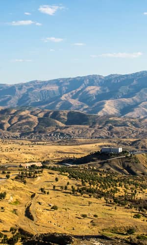
My colleague continues by questioning one location upon which my cultural evidence appears to converge. This seems to be the sticking point for her. Obviously, the scriptural criteria for where the Ark landed are paramount, and the extra-biblical criteria are only secondary. It bears repeating that, although inspired by my initial correlation between the Egyptian mound of creation and Masher Dag/Yigityatagi, the latter may not be the only site which matches. Yet, out of the five main contending locations I have found (within the current Ark-search literature), it seems to be the most promising. Yet Habermehl seeks to drive a wedge between the historical science of cognitive archaeology and the operational aspects of modern geology. This will not do. She claims that the controversial boat-shaped object is “at Mount Tendurek”. To be fair, others, including William Shea (1976, 90–95) and the authors of Wikipedia, seem to have mistakenly located it there as well. Yet to be more precise, it is 20.53 mi from the volcanic caldera of Tendurek—at coordinates 39°26’26”N 44°14’06”E (and 1,963 m above sea level). My readers can confirm this for themselves, if they so wish, by measuring the distance on Google Earth.
Now, this is a particularly eyebrow-raising oversight, since over 30 years ago David Fasold himself (1990, 32) took great pains to correct his critics on the true location: “there is not a Turk in the area who would ever agree that these mountains were the foothills of Tendurek . . . Charts of the area clearly mark the site as being on the Akyayla Dagi (High White Plain), quite removed from Tendurek, one of Turkey’s most active volcanoes.” Perhaps even more concerning that this inexactitude, my colleague seems to think that volcanoes are made of white sedimentary limestone! Unfortunately for her argument—they are not! Twin-peaked Masher Dag/Yigityatagi is not a ‘shield volcano’ (it is a limestone rock surrounded by muddy/marshy ground mixed with basalt boulders (ejecta?), pools of water, and the sound of croaking frogs). If the earthflow hypothesis were actually correct (which remains to be seen), the coordinates of the Ark’s original grounding place, adjacent to the limestone peaks, would have been 39°25’29”N 44°14’23”E (and 2,251 m above sea level)—which is still over 20 mi away(!) from the volcano where Habermehl desperately wants the location to be in order for her argument to bear careful scrutiny.
Next, the claim is made that I don’t sufficiently justify my choice of five possible locations for where the Ark landed. I should point out that, despite it being the biggest prize (if eventually found), the location of the Ark was not the main concern of my paper. Rather, the main concern was to build a cumulative case to show that the footprint of the historic Genesis Flood was ubiquitous in ancient material cultures and religions (via the East Mediterranean koine, surrounding the Cosmic Mountain and the Ogdoad). This goal is arguably even more important than finding the Ark itself, because the ruin of a large boat in the mountains of Ararat could be interpreted by secularists as just that—a large boat, totally unrelated to Noah or the global Flood. This was the reason why so much space was devoted to iconographical comparanda across the A.N.E., while my justification for the five contending Ark sites was reduced to just a footnote. As I said in that footnote, there could be other locations which equally match the accumulated evidence of the koine—but a topographical search was not within the remit of the paper. Since the publication date, I have found another symmetric twin-peaked candidate named Mount Bingöl (north of Göbekli Tepe). Yet this is most unlikely to be the mountain of the landing site, for reasons which both Habermehl and I would no doubt agree upon—the rim of a shield volcano is simply out of the question. Nevertheless, I do not agree with my esteemed colleague that the number of possible sites (in light of biblical and Flood koine criteria) is in any sense large. To recap, in addition to the major biblical criteria which must be adhered to, the true mound of the landing, in light the koine thesis, would be expected to also be:
- White in colour—either due to snow cover or chemical composition.
- Surrounded by a marshy or muddy environment (associated with reptilian life).
- North of Sumer (Mesopotamia) and ‘above Minni’ (naturally taken as ‘direct north of’ Minni).
- Near to the ‘source of the rivers’ (Tigris and Euphrates), not the outlet of the rivers (Persian gulf).
- Within ancient ‘Dilmun’ (and reachable/climbable/surmountable by Sargon of Akkade in the third millennium BC.)
- In a location where a large ancient cedar forest once grew, for instance the Upper Zagros Mountains and beyond (compare Izady [1992, 19]).
- Directly associated by its distinctive morphology with the Ogdoad of Hermopolis in ancient iconography (which my paper—and those of Cox 2019 and 2020—identify with Noah’s family).
- Constituted by two symmetrical peaks with an incurved escarpment (or notch) in between.
- A once famous place of pilgrimage, either with some graves or a large, buried necropolis.
- A mound once covered in special stones (which were recorded as being ‘removed’ from the ‘Great Wall of Heaven and Earth’ by Sargon; which once had ‘retaining ropes’ through them according to Gilgamesh and which were ‘flung behind’ Noah and his wife Pyrrha according to Ovid—resulting in the nucleation of population centres).
Now let us look at the facts as they appear on the ground:
Yigiyatagi is white in colour due to composition, and its peaks are symmetric. It is surrounded by a mud earthflow with water springs and copious frogs in the vicinity (mirroring Egyptian temple floors). It is north of Sumer; near to the source of the two rivers; within ancient Dilmun; probably once forested with cedars; of precisely the correct geomorphology to be graphically represented as an incurved mound and white wall; has one peak named Ziyaret Dag which literally translates as Voluntary Pilgrimage (and where old graves have now been found according to Nissen (2004, 76). Finally, it is surrounded by possible anchor (drogue) stones, of the correct size and shape to be used behind the Ark as stabilizers (and since we simply don’t know the mineral composition of stones from before the Flood, their chemical analysis cannot really be used as an argument for in situ origin). If these stones have no bearing upon the Ark whatsoever (as I suspect my colleague would argue), one must have a good explanation as to why they are only found (to my current knowledge) in this precise location, and why some of them have extant anti-chaffing holes (cut to slope inwards, so they are fit to tie a rope to so that the knot slides into the hole and stays put). Moreover, we might also ask Habermehl why any ancient culture would expend enormous resources of time, energy, and skill drilling large unaligned holes in large rocks in the first place? Alternative explanations (such as the holes were used as lamp holders) sound quite unconvincing and contrived. The question is, can any other possible site known to Ark hunters (Cudi Dagh included) claim such remarkable consistency with the Flood koine? Personally, I think not.
My honorable critic also believes that I spread my net too wide in looking for examples of twin-peaks. In retrospect, I believe that I may have cast it too narrow by focusing just upon examples from the ancient Near East! Consider the Americas. In 1897, a large statue was found between two peaks of the volcano of San Martin Pajapan, in the Tuxtla Mountains on the Gulf coast of Veracruz. This was the Olmec sacred mountain of creation. The statue depicted an Olmec ruler kneeling and grasping the trunk of the World Tree—a cosmic axis (Devereux 2000, 173). Again, Mayan stepped pyramids, standing in plazas, represented the First True Mountain rising out of the primordial waters or sea of creation. Some of the temples on their summits have twin pillars and collectively they represent portals to the underworld (just as the koine predicts). Once again, the mysterious civilization behind the city of Teotihuacán framed its Pyramid of the Moon against the sacred notched mountain Cerro Gordo. Finally, in Meso-America, the Aztec civilization built their Great Temple, which they took as their world navel, in the form of two sacred hills (which taken together as a pair symbolized the portals of Mictlan, the realm of the dead) (Trigger 2007, 468). According to Massey (1907, 269) an Aztec elder once told Cortez: “Our fathers dwelt in that happy and prosperous place which they called Atzlan (a word that signifies whiteness). In this place there is a great mountain in the middle of the water, which is called Culhuacan, because it has the peak turned somewhat over toward the bottom; and for this cause it is called Culhuacan, which means ‘crooked mountain” [or curved mountain].
Further North, in British Columbia, we find the Tahltan tribe had this remarkable account of the Flood:
Only two peaks in the Tahltan country were not covered by the deluge, Takitstsitla on the west side of Chesley River, and Tsetoxtle on the south side of the Stikine River. . . . Some people reached the two mountains in the Tahltan country, and went ashore. (Liguori 2021, 37–38)
It must be acknowledged that these are not isolated examples, cherry picked to fit my thesis. The same twin peak motif is ubiquitous globally—and found in such far removed places as Australia and Scotland! In Australia, for instance, the cosmic mountain of the ancient Walbiri and Ngalia tribes was known as Winbaraku, a symmetric twin-peaked hill where all dreamtime beings (including the rainbow serpent) originated from at the time of creation (Devereux 2007, 167). In the islands of the Scottish Inner Hebrides, the symmetric Paps of Jura (Jura denoting the moon in Celtic) formed the twin-peaked backdrop for the sacred ritualistic landscape and administrative centre around Cnoc Seanndda (Devereux 2000, 157–160).
It is understandable that some readers, less familiar with ancient cosmography and kingship, may find incredulous my inclusion of the twin pillars of Solomon’s Temple, and the twin pillars found within the enclosures of Göbekli Tepe (a place whose very name in Turkish means “navel-like [göbekli] hill [tepe]”) in my cumulative argument for the koine. However, there are many good reasons for their inclusion which space did not really permit me to go into fully.
Regarding Solomon’s Temple, first, as Meyers (1983, 174), whom I reference, points out: “inhabitants of the biblical world, from Sumerian times down through the neo-Assyrian period and later, were familiar with a variety of iconographic depictions of shrines in which the whole structure or temple was indicated by a pair of columns. These columns seem to represent either the doorposts of the shrine itself or the gateway that provided access to the sacred area as a whole. . . The critical meaning is the notion of passage from profane space to holy space, from the mundane to the supra-mundane. The doors and/or gates stand for the holy and mark this highly significant boundary.”
Second, we have historical precedents of the twin pillars, facing eastward, in temples at Cretan Knossos, throughout Egypt and in coastal Tyre. At Knossos, it is well established that a beam of dawn light reached the inner throne room and did so between two pillars. At Knossos, writes Hammond (2007, V 41–42), “the doorway or door jamb in itself, . . . drew a symbolic function not only from the symbolism of sunlight, but from the symbolism of the pillar—which could be a notional (split) mountain, or single tree.”
Hammond continues, citing Morgenstem (1960) and Josephus:
There is a close parallel in the documented design and function of the tenth century BC palace of Hiram at Tyre, which provided an east-facing location for solar, hence ‘radiant,’ appearances of the king-god at the dawn of winter solstice as part of rituals of renewal. The eastern aspect of Hiram’s temple was dressed with two pillars, as was the east of the temple of Solomon which was near-contemporary with it. The king, symbolizing the resurrecting sun-god, was to emerge from the netherworld with the rising solstice between these pillars, which represented the split cosmic mountain (cosmic portal).
This is only to be expected, of course, because the two temples were likely designed by the very same architect—namely Huram of Tyre (not to be confused with the king). And if it be queried why Huram should be allowed to incorporate pagan solar symbols into the Solomonic Temple (at odds with the temple design revealed by God to David), we should do well to ponder the recently discovered seal impression depicting a two-winged sun disk flanked by ankh symbols and containing a Hebrew inscription that reads “Belonging to Hezekiah, (son of) Ahaz, king of Judah.” Hezekiah was a godly king, who made reforms. Would he allow his own named property to be decorated with idolatrous symbols? Such symbols then, common to Israel and Judah, were most probably referencing an ancient historical event—that is, the landing of the Ark—which was not of pagan superstitious origin at all (but was liable to abusive veneration).
Indeed, my argument is that if the Ark of Noah landed near the summit of two peaks (as Benjamin Tudela recorded), and it was understood as a sacred microcosm (as were ancient temples), then extra light might well be shed on the two architectural pillars of many A.N.E. temples, including Solomon’s Temple. Furthermore, whilst it is true that the twin pillars of Göbekli Tepe were not orientated towards the sun, this is of little real consequence. The pillars are orientated north (towards the celestial pole). As such, they would still have been viewed as bifurcated portals or gates, linking the center of the earth with the rotation of the starry canopy and the abode of the gods above. This, of course, explains why in pagan traditions, Noah was supposedly translated ‘far distant’ to the gods, via the twin-peaked mountain-gate or bridge across worlds. Recall that Egyptian Horus was also known as ‘The Distant One’, as was Wa—one of the eight Egyptian ‘Shebtiu’ who floated in the reed when every existing thing was flooded. Pyramid Text 1207–1210, concerning Horus at this time of creation, is quite revealing:
“O Morning Star, Horus of the Netherworld, divine Falcon, bird whom the sky bore . . . give me these your two fingers which you gave to the Beautiful, the daughter of the great god, when the sky was separated from the earth, when the gods ascended to the sky, you having a soul and appearing in front of your boat of 770 cubits which the gods of Pe bound together for you, which the eastern gods built for you.”
Intriguingly, a bound boat of 770 cubits is almost three times the length of Noah’s Ark! One wonders if the Egyptians were here tacitly referring instead to the 900-cubit total length of all three decks aboard the Ark (minus some space for food storage or a hull pool).
Some excellent and probing questions are subsequently posed, such as why multiple images of the cosmic mountain occur in some instances of A.N.E. iconography when there was only one Ark and one landing place. The best reason, I would suggest, is related to the ancient cosmographic notion of the Four Quarters (or corners) of the terrestrial plane (as evinced in the Gilgamesh Flood tablet XI, “I brought out an offering and sacrificed to the four corners of the earth. I strewed incense on the ziggurat of the mountain.)” Marinatos (2010, 107) sheds some light on the matter when she writes: “The twin peak mountain defines the edges of the cosmos. Three pairs of [twin peaks] would cover three sides of this imaginary cosmic triangle, and four pairs would define an entire square. For this reason [it] occurs in double, triple, or even quadruple numbers.” More on this cosmographical concept can be found in Trigger (2007) and Perry’s work, ‘Lord of the Four Quarters: The Mythology of Kingship’ (1991), which I reference at the end of this discussion. The concept appears to be an echo of the four rivers which flowed from the central garden of Eden, which was subsequently reapplied to the landing site of the Ark (hence the post-diluvian river names, Tigris and Euphrates, which have their sources nearby).
Contra Habermehl’s claim, however, mentions of the Ark (or its constituents) occur in many of the cuneiform tablets which I cite, not just in one of them. For example, within the Ark Tablet, the manufacture of Noah’s boat is directly associated with the bound fibres of the palm tree, which tree was sacred to the Egyptian sun god Re and which we frequently encounter between two peaks in A.N.E. iconography. On the Babylonian Map of the World, according to Finkel, the text relating to (mountain/island) Nagu IV represents a direct quotation from the Old Babylonian version of Epic of Gilgamesh (regarding the 50 cm thick logs of the Ark which made up its massive ribs). This is further corroborated by the Map introduction, which in line 10 mentions Noah by name (and where he first inhabited). In the Assyrian Gilgamesh Epic, which alone preserves the name of the Ark-mountain, Mount Niṣir (or Nimuš) is mentioned exactly four times (that is, “Mount Niṣir held the boat fast and did not let it move” × 4). As I related, this name has a Babylonian/Akkadian root behind it, naṣāru, to guard, protect, which ties in with koine guardians—lions, griffins, and sphinxes found in iconographical comparanda. There could well be significance behind the name of the mountain bearing fourfold repetition here since we find precisely four renditions of a twin-peaked mound around the rim of the Map reconstruction. Moreover, in the biblical account, once the Ark is held fast, Noah employs birds precisely four times in reconnaissance missions over a period of precisely three weeks. Suggestively, in exactly three mountain peaks on the Babylonian Map we find the phrase “6 leagues in between” written. This would obviously need further confirmation by an expert in Babylonian cuneiform, but I suspect the distance-related term leagues might also be translated as a length of time, that is, days, in which case the Map might also be referencing the three periods of seven days (with six days in between) mentioned in Genesis chapter eight. One bonus of this suggestion is that it neatly explains why the Map tablet author later enigmatically names himself as “son of Bird, descendant of Ea-bel-ili.”
Regarding biblical chronology, I hold to a careful reading of the MT chronology in which the Genesis Flood occurred ca. 2610 BC. (This is based on various assumptions, including a long sojourn of the Israelites in Egypt and a large post-Flood Atlantic impact event close to 2350 BC in the days of Peleg). Since I experienced great difficulty gaining acceptance for this Flood date during the Answers Research Journal peer review process, I decided to leave my chronological calculations somewhat vague in the paper. Certainly, whatever one’s ultimate judgements, Habermehl’s chronological studies are worthy of detailed consideration as we all try to gain an accurate understanding of when ancient events took place. But extreme dogmatism in chronological matters should at all costs be avoided, as there are so many rabbit holes which seem correct at first!
On a related note, a fair degree of uncertainty is unavoidable in the historical sciences (ideational cognitive archaeology included). Christopher Hawkes (1954) famously developed his hierarchy, which was a scale of ascending difficulty in the reconstruction of various aspects of past life, putting ancient religious beliefs at the very top! Yet as Alexander von Gernet (1993, 69 and 72) noted: “analogical reasoning . . . forms the basis of both ‘functionalist’ and ‘cognitive’ archaeologies . . . since the existence of regularities is what makes analogical reasoning and, hence, reconstruction of the past possible, the definition of the limiting conditions or constraints which produce such regularities has emerged as a major aim in archaeology . . . Since anatomically modern humans presumably evolved from one ancestor, and as migration not only involves a geographic spread of biological entities but the dispersal of cultural baggage, all Homo sapiens sapiens are in a sense historically related, no matter how isolated they may have become . . . The theoretical extension of historical relatedness to all of humanity is, of course, exceedingly difficult to demonstrate, and such an attempt would, in any case, bear an uncomfortable resemblance to the excesses of 1920s hyper-diffusionism. Nevertheless, it is widely accepted that some aspects of culture do not arise sui generis, but are vestiges of a previous heritage carried through long periods of history. As historians of religion have noted, no belief system is completely new . . . ”.
This quotation, coming from an avowed evolutionist, is most revealing! The early chapters of Genesis do make historical/scientific predictions which can be tested through fields such as I.C.A. Since Habermehl herself admits that the Ark landed in just one place, a ‘world navel’, in the sense of a single point of origin for the diffusion of all people and all cultures, is inescapable. Hyperdiffusion is thus also inescapable. When we get inside the ancient mind, it becomes increasingly clear that their creation accounts are, more often than not, recreation accounts (that is to say, Flood survival accounts). Everything in the ancient world is connected by virtue of this fact, in complete agreement with the Christian Scriptures.
Habermehl concludes: “Claiming that the Ark must be at Durupinar, based on assumptions, and ignoring science, will find a theoretical Ark location on paper, but will not produce a real Ark.”
I fully agree with her, but this is certainly not my paper, it is a figment of my colleague’s imagination. Serious attention should be paid to the Flood koine I have expounded within the cultural-historical sciences if we are to make real progress in finding the Ark of Noah, for the glory of God, in the field of apologetics. Although nowhere explicitly stated, my paper did follow a combination of two standard scientific methodologies in cognitive archaeology, namely the ‘Established Generalization Testing method’ (major details of epoch-making ancestral victories are physically memorialised and/or idolised in subsequent material cultures) and the ‘Tight Local Analogy method’ (supposedly prehistoric, proto-literate icons, elucidated in meaning through stabilizing iconographical, textual, and architectural analogies which are at a level of universality beyond particular cultural peculiarities) (Hill 2000, 83–92). But whether we scientifically document remains of the Ark or not, the Flood koine will still stand, God willing, as a remarkable insight into the workings of the ancient mind, and as a testament to the reliability of God’s Holy Word. Rather than more fog, I pray this response would provide a brilliant ray of light upon a rather obscure matter, leading us all to agree of the Scriptures: “Thy word is true from the beginning: and every one of thy righteous judgements endureth forever” Psalm 119:160.
References
Butterworth, Edric. 1970. The Tree at the Navel of the Earth. Berlin, Germany: Walter de Gruyter & Co.
Cox, Gavin. 2019. “The Search for Noah and the Flood in Ancient Egypt—Part 1.” Journal of Creation 33, no. 3 (December): 94–101.
Cox, Gavin. 2020. “The Search for Noah and the Flood in Ancient Egypt—Part 3.” Journal of Creation 34, no. 2 (August): 67–74.
Devereux, Paul. 2000. The Sacred Place: The Ancient Origin of Holy and Mystical Sites. London, United Kingdom: Cassell and Co.
Devereux, Paul. 2007. Spirit Roads: An Exploration of Otherworldly Routes. London, United Kingdom: Collins & Brown.
Eliade, Mircea. 1958. Patterns in Comparative Religion. Translated by Rosemary Sheed. London, United Kingdom: Sheed and Ward.
Eliade, Mircea. 1961. Images and Symbols: Studies in Religious Symbolism. Translated by Philip Mairet. London, United Kingdom: Harvill Press.
Fasold, David. 1990. The Discovery of Noah’s Ark: How the World’s Greatest Archaeological Mystery was Solved. London, United Kingdom: Sidgwick and Jackson.
Hammond, Rosemary Margaret. 2007. “Cosmological Motifs and Themes in the Odyssey of Homer, With Some Antecedents in Minoan and Mycenaean Iconography.” PhD thesis. The Open University.
Hawkes, Christopher F. 1954. “Archeological Theory and Method: Some Suggestions From the Old World.” American Anthropologist 56, no. 2, part 1 (April): 155–168.
Hill, James N. 2000. “Prehistoric Cognition and the Science of Archaeology.” In The Ancient Mind: Elements of Cognitive Archaeology. Edited by Colin Renfrew and Ezra B.W. Zubrow, 83–92. Cambridge, United Kingdom: Cambridge University Press.
Hruška, Blahoslav. 1996. “Zum ‘Heiligen Hügel’ in Der Altmesopotamischen Religion.” Wiener Zeitschrift Für Die Kunde Des Morgenlandes 86: 161–175.
Izady, Mehrdad R. 1992. The Kurds: A Concise Handbook. London, United Kingdom: Crane Russak.
Liguori, Nick. 2021. Echoes of Ararat: A Collection of over 300 Flood Legends from North and South America. Green Forest, Arkansas: Master Books.
Marinatos, Nanno. 2010. Minoan Kingship and the Solar Goddess: A Near Eastern Koine. Champaign, Illinois: University of Illinois Press.
Massey, Gerald. 1907. Ancient Egypt: The Light of the World. Vol. 1. Lulu.com.
Meyers, Carol L. 1983. “Jachin and Boaz in Religious and Political Perspective.” The Catholic Biblical Quarterly 45, no. 2 (April): 167–178.
Morgenstem, Julian. 1960. ‘The King-God Among the Western Semites and the Meaning of Epiphanes.” Vestus Testamentum 10 (1 January): 138–197.
Nissen, Henri. 2004. Noah’s Ark Uncovered: An Expedition into the Ancient Past. Copenhagen, Denmark: Scandinavia Publishing House.
Perry, John Weir. 1991. Lord of the Four Quarters: Mythology of Kingship. Reprint. Mahwah, New Jersey: Paulist Press International.
Powell, James. 2022. “Decoding a World Navel “Visual Language” Through Ideational Cognitive.” Answers Research Journal 15 (October 12): 301–337. https://answersresearchjournal.org/noahs-flood/solar-koine/.
Pritchard, James B. ed. 1969. Ancient Near Eastern Texts Relating to the Old Testament. Princeton, New Jersey: Princeton University Press.
Shea, William. H. 1976. “The Ark-Shaped Formation in the Tendurek Mountains of Eastern Turkey.” Creation Research Society Quarterly 13, no. 2: 90–95.
Sjöberg, Åke W., and Eugen Bergmann. 1969. The Collection of the Sumerian Temple Hymns. Locust Valley, New York: J. J. Augustin.
Skully, Vincent. 2013. The Earth, the Temple and the Gods: Greek Sacred Architecture. Rev. ed. San Antonio, Texas: Trinity University Press.
Tolstoy, Nikolai. 2016. The Mysteries of Stonehenge: Myth and Ritual at the Sacred Centre. Gloucestershire, United Kingdom: Amberley Publishing.
Trigger, Bruce G. 2007. Understanding Ancient Civilizations: A Comparative Study. Paperback ed. Cambridge, United Kingdom: Cambridge University Press.
Volpe, Angela Della. 1990. “From the Hearth to the Creation of Boundaries.” The Journal of Indo-European Studies 18: 157–184.
Von Gernet, Alexander. 1993. “The Construction of Prehistoric Ideation: Exploring the Universality-Idiosyncrasy Continuum.” Cambridge Archaeological Journal 3, no. 1 (April): 67–81.
Wyatt, Nicolas. 2001. Space and Time in the Religious Life of the Near East. Sheffield, United Kingdom: Sheffield Academic Press.


